We had an amazing time when Purple Pig Company came to visit us at school. All of our families loved it too!
Click on the link below to see what we got up to…
Post geography content here
We had an amazing time when Purple Pig Company came to visit us at school. All of our families loved it too!
Click on the link below to see what we got up to…
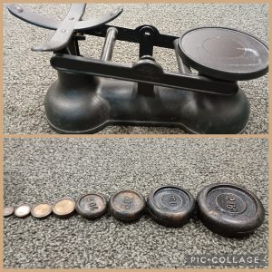
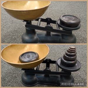
Today we explored our new balance scales, thinking carefully about how the scales moved, ‘heavier’, ‘lighter’, ‘the same’ and what it meant when they were balanced.
We then talked briefly about the origins of Pancake Day and looked at different types of pancakes across the world; from Russian blinis to the Irish boxty. All of them were circular shapes. Fancy that!
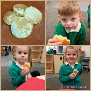
The children told us all about the pancakes they had eaten over the holidays.
Autumn used some super sentences. She told us, “I had strawberry pancakes.” “I had pancakes at home and at Nana’s.”
Oliver said, “I had jam on the other one and nutella on the other one,” as he counted on his fingers, showing us two.
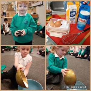
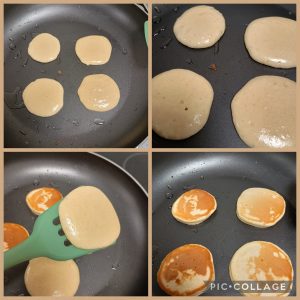
We looked at the recipe book and measured out the ingredients using our new scales then poured it into the mixing bowl.
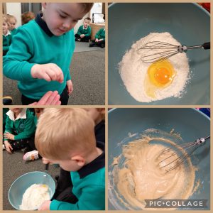
Blake added a pinch of salt then Jax started to mix everything together. “It’s mixed in the flour,” he told us.
Myla knew that they needed cooking ‘in a pan’. So Mrs Silverwood got cooking.
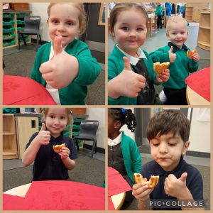
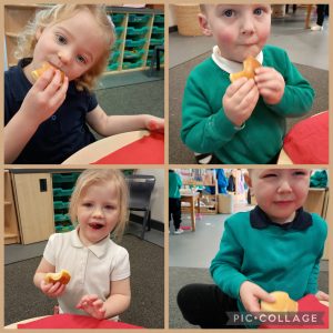
Nearly everyone thought they were tasty.
“They’re delicious,” said Jacob.
“Really nice, me eat it all,” said Blake.
“Nice,” said Arlo B.
“I just like them,” said Jax.
“I want another one,” said Arlo R.
“I like it really good,” said Nevaeh.
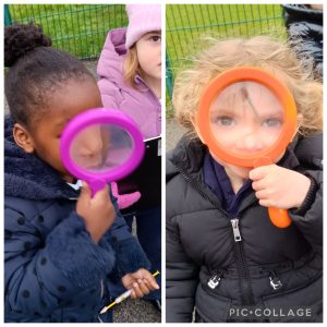
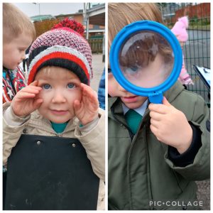
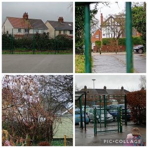
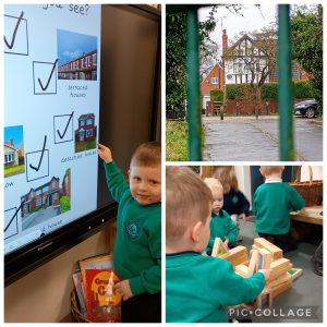
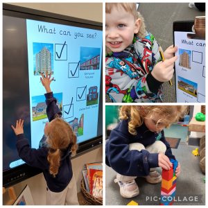
We have been thinking about houses in F1 recently. Today we went out to hunt for different styles of homes that we can see from our grounds. The children had a great time spotting them and trying hard to use the new words we had discussed before we went outside, such as bungalow, detached and terraced.
Here are a few photographs of us busy at work…
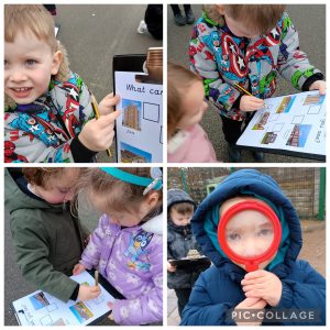
When we got back into school, some of the children used what they’d learnt to build their own homes too!
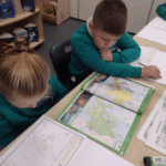
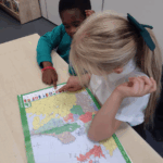
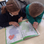
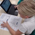
This week in geography, Year 3 have been using atlases.
We have begun to identify countries in Europe with the use of an atlas. We could identify England, Scotland, Wales and Northern Ireland independently. We then began to find France, Belgium and The Netherlands as these are the countries which are closest to Hull.
We can use our atlas and our knowledge of compass points to find European countries which are north, south, east or west in relation to where Hull is.
We enjoyed using the atlases and worked together to identify lots of European countries.
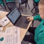
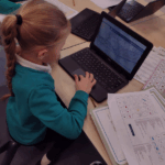
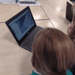
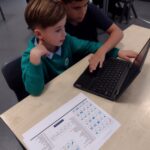
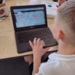
As part of our geography this term, Year 3 have been using digimaps on the computers. We have been able to look at maps of our local area and identify features from them.
Today, we have used ordinance survey icons to help us. We first identified symbols that were on our maps then used an ordinance survey key to help us identify what these features were. We looked at maps from moderday, 1950’s and 1890’s to compare any changes that had happened in our local area. We quickly spotted that things like churches have always been in our local area. We also spotted that things like viewing areas are a newer addition to our area as these were not on the earlier maps.
We really enjoyed using these ordinance survey symbols to help us identify lots of different features in our local area.

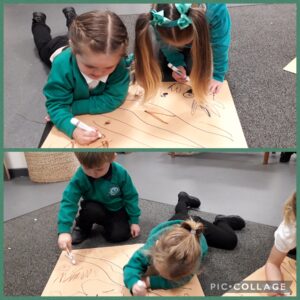
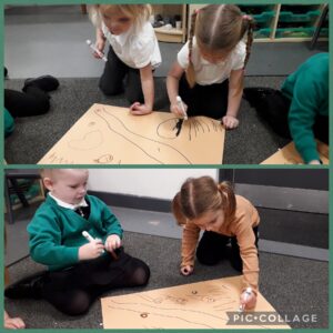
Today some of our children worked together to draw out maps of everything that they thought Goldilocks might see on her walk through the wood. They came up with all sorts of ideas; trees, flowers, grass, the three bears, some birds and… a dragon!
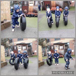
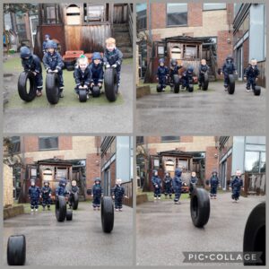
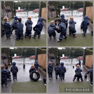
The wet weather never stops F1 from having fun! Yesterday, Florence started her own game, rolling a tyre to see how far it would travel. It soon became a very popular game and lots of children joined in. Well done everyone!
Year 3 had the fantastic opportunity this term to complete fieldwork comparing villages and towns.
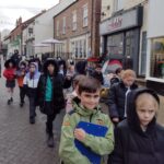
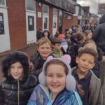
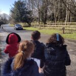
We began our fieldwork by visiting the local town of Hessle. We were lucky to be able to walk to the town where we discussed the differing types of land use we could see as well as recording the different types of buildings we passed on our walk. We saw lots of different shops in Hessle including food shops, pet shops and a post office. There were many pubs and we walked past 2 churches as well as local park. We discussed the size of populations in towns and if all these facilities were needed. Before we left Hessle we had the opportunity to carry out a traffic survey. We used a bar method to record all traffic that past us in a 5 minute period. We kept our findings ready to compare with what we discovered on our next fieldwork trip.
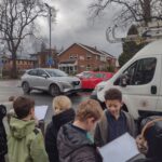
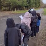
Next, we had the opportunity to visit Brantingham. This is a local village, we had to use the school minibus to get here as it was a little further than Hessle. Again, we discussed the types of land use we could see in Brantingham and recorded the building we saw as we walked around. This time there were no shops, no post office and there was only one pub and one church. We discussed the size of populations in villages and we were very surprised that it did not take us long to walk the whole length of Brantingham. Before we left we carried out a traffic survey. Again, we used a bar method to count all vehicles that passed us in a 5 minute period.
When we were back at school we were able to compare Brantingham with Hessle. We were all shocked to compare the findings of our traffic survey. When we were in Hessle we struggled to record all the vehicles but in Brantingham we were waiting for them to come past us. Only 4 vehicles passed us in Brantingham! We compared the shops and facilities of both areas and discussed how a town would need these facilities more than a village due to its bigger population. We also discussed how land use in a town had more commercial and industrial use than a village which had more agricultural and forestry use and the reasons for this.
Year 3 really enjoyed our field work and seeing these types of settlements for ourselves made us realise the huge differences between them both.
As part of our geography this term, Year 3 have been using an amazing online resource called digimaps. We have been able to look at different maps from 1890’s, 1950’s and today. We have compared our local area and discussed the developments that have taken place.
As part of us comparing these maps we needed a way to look at all these maps in the same way. We used ordinance survey icons to help us and we quickly spotted that things like churches have always been in our local area. We also spotted that things like viewing areas are a newer addition to our area as these were not on the earlier maps.
We really enjoyed using these ordinance survey symbols to help us identify lots of different features in our local area.
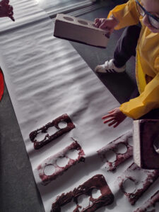
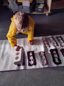
This week Mrs Buss had changed around some of our classroom and had started to create a fabulous space for us to build some houses!!! The children were a big help and wanted to build a house using bricks! We discussed what houses were made from and how our own houses were built.
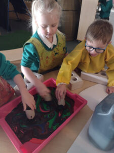
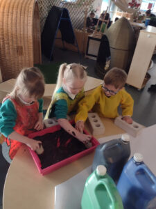
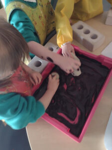
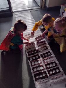
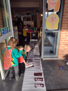
We decided to do some brick printing ready to create one of our houses. We had great fun looking at bricks, and the colours. The children mixed lots of colours together to make the perfect brick shade red/brown and loved getting stuck in pushing their bricks and stamping on the paper! We made a great brick wall and had lots of fun in doing so!
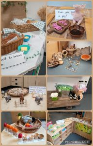
This term our topic is ‘Houses and Homes’ and we will be looking at different houses around the world and how they are made… Can you guess what our story could be in Literacy? Something with a brick house, a straw house and a stick house…