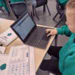
As part of our geography this term, Year 3 have been using digimaps on the computers. We have been able to look at maps of our local area and identify features from them.
Today, we have used ordinance survey icons to help us. We first identified symbols that were on our maps then used an ordinance survey key to help us identify what these features were. We looked at maps from moderday, 1950’s and 1890’s to compare any changes that had happened in our local area. We quickly spotted that things like churches have always been in our local area. We also spotted that things like viewing areas are a newer addition to our area as these were not on the earlier maps.
We really enjoyed using these ordinance survey symbols to help us identify lots of different features in our local area.