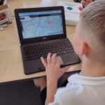
As part of our geography this term, Year 3 have been using an amazing online resource called digimaps. We have been able to look at different maps from 1890’s, 1950’s and today. We have compared our local area and discussed the developments that have taken place.
As part of us comparing these maps we needed a way to look at all these maps in the same way. We used ordinance survey icons to help us and we quickly spotted that things like churches have always been in our local area. We also spotted that things like viewing areas are a newer addition to our area as these were not on the earlier maps.
We really enjoyed using these ordinance survey symbols to help us identify lots of different features in our local area.