Y5 Geographers
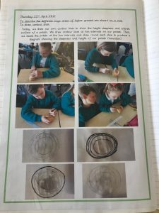
Whilst we were exploring the world’s mountain ranges, we were able to find their heights at their summit. We noticed other lines on the maps and today we learned that these are called contour lines which indicate the steepness of which a hill or mountain rises.
We had great fun trying to record contour lines of our mini potato mountains! By carefully cutting layers off the potato mountain we could record the shape and the gradient and create a representation of the mountains slope.